Cap Malheureux — The Red Church and Mauritius's Most Iconic View
Last updated: June 2026 · By Bilaal Sadeer
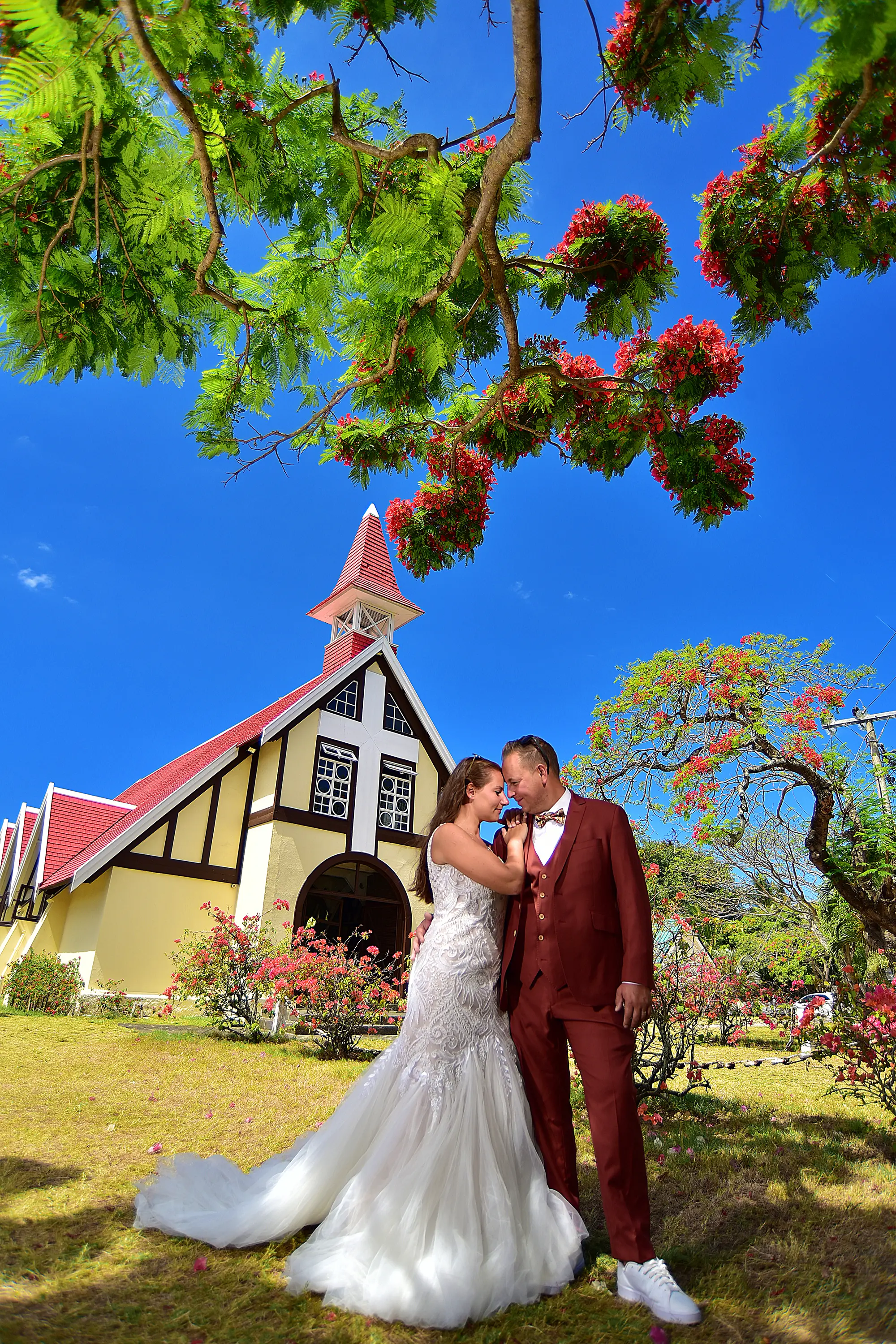
At the very northern tip of Mauritius, a small red-roofed church sits on the edge of the Indian Ocean with a volcanic island rising from the turquoise water less than four kilometres offshore. Notre-Dame Auxiliatrice de Cap Malheureux has appeared on more postcards, travel books and Instagram feeds than any other single location in Mauritius — and for good reason. The combination of the terracotta tile roof, white coral-stone walls, fishing village and the silhouette of Coin de Mire island on a clear day produces a scene that feels almost too perfect to be real. I have photographed here hundreds of times. This guide tells you everything you need to know — the history, the best photography positions, what Coin de Mire island actually is, and what else is in the area.
Cap Malheureux — Key Facts
- Mauritius's northernmost point — closest land on the main island to Coin de Mire island (4km offshore).
- Notre-Dame Auxiliatrice: red Marseille tile roof, built 1907 by French Catholic missionaries, active parish today.
- Church faces north — morning light (8–10am) is best for photography; facade catches direct sun from the east-north-east.
- Coin de Mire: 280m volcanic monolith, uninhabited nature reserve, visible on clear days as a dramatic silhouette.
- Grand Baie 10 minutes south — shopping, marina, restaurants, nightlife.
- Historical: nearby beach was the landing site of British forces during the conquest of Mauritius in 1810.
Why Cap Malheureux Is Mauritius's Most Famous View
There are beautiful locations all around Mauritius — the black rock cliffs at Le Morne, the mirror-flat lagoon at Belle Mare, the sugar cane fields that roll down to the sea in the south. But Cap Malheureux does something none of them do: it concentrates three perfectly contrasting elements into a single frame. The red of the church roof. The white of the coral-stone walls and the surf. The impossible turquoise of the Indian Ocean. And then, floating on the horizon, the dark volcanic pyramid of Coin de Mire island.
This is why Cap Malheureux appears on the cover of the Lonely Planet Mauritius guide, on the Air Mauritius safety card, on every postcard sold at the airport, and on the screensavers of people who have never been to the island but want to go. The image is almost a logo for Mauritius itself. The scene is compact enough to fit in a single photograph — you do not need a wide-angle lens, you do not need special access — and yet it contains enough layers of colour, depth and cultural meaning to hold the eye for minutes.
What makes it emotionally powerful is the fact that it is real and working. Notre-Dame Auxiliatrice is not a ruin, not a museum, not a set piece built for tourists. It is an active Catholic parish with a congregation that has been attending Sunday Mass here since 1907. Fishermen tie their boats on the beach beside it. Children walk past it on their way to school. The red roof has faded and been repainted. The coral-stone walls have absorbed 119 years of tropical rain. The church exists inside a living village, and that ordinariness — set against the extraordinary backdrop of the Indian Ocean and Coin de Mire — is what gives the scene its emotional charge.
For photography, the location is also unusually democratic. You do not need a permit, a hotel room, a boat, or a guide. You park your car on the roadside, walk thirty metres to the public beach, and the shot is in front of you. That accessibility has made it the most visited photography location on the island — but it is large enough and varied enough that the same scene yields completely different results depending on the time of day, the tide, the cloud, and where exactly you choose to stand.
Notre-Dame Auxiliatrice — The Red Church
Notre-Dame Auxiliatrice de Cap Malheureux was built in 1907 by French Catholic missionaries as a chapel to serve the fishing communities of the northern coast. The structural material is coral stone — the same material used in most historic buildings across Mauritius — and the roof is covered in red Marseille terracotta tiles, which were a common import in colonial Mauritius and gave the chapel its defining visual character. The combination of warm coral stone and vivid red clay tile, set against the blue sea, was probably not calculated for aesthetic effect. It was simply the way things were built. The result is one of the most photographically compelling small buildings in the Indian Ocean.
The church is small by any standard — a single nave, perhaps twenty rows of pews, a simple altar, a small sacristy. The stained glass windows are modest but beautiful: the blue and amber glass throws coloured light across the stone floor in the morning, and the effect inside is unexpectedly serene given the building's fame outside. Many visitors walk straight past the entrance to photograph the exterior and never look in. Those who do often describe it as the more moving experience of the two.
Opening times are approximately 7am to 6pm daily. Mass is celebrated on Sundays and on Catholic feast days — check the notice board at the gate for exact times before visiting, as schedules shift seasonally. Entry is free and visitors are welcome at all times outside of active services. Photography is permitted both outside and inside the church. Bringing a tripod is technically allowed outside service hours, but setting one up during a Mass or on a Sunday morning when the congregation is arriving is not appropriate — be respectful, read the mood of the space, and if in doubt, use a camera without a tripod. The priest and parishioners are accustomed to cameras; they do not need to be ignored, but they deserve not to feel like subjects in a zoo.
Best angles from outside
There are two principal positions for photographing the church facade. The first is from the small public beach to the left (east) of the church, which gives you the full building including the red roof, the white walls, the ocean, and Coin de Mire island in the background — all in a single frame. This is the postcard shot. The second is from the road in front of the church, looking straight at the facade with fishing boats and the sea visible on either side. The road position gives a tighter, more architectural composition that emphasises the symmetry of the building.
Photography at Cap Malheureux — 5 Specific Positions
I have photographed Cap Malheureux in every light condition and at every time of day. These are the five positions that consistently produce exceptional results.
Position 1: The Public Beach to the Left
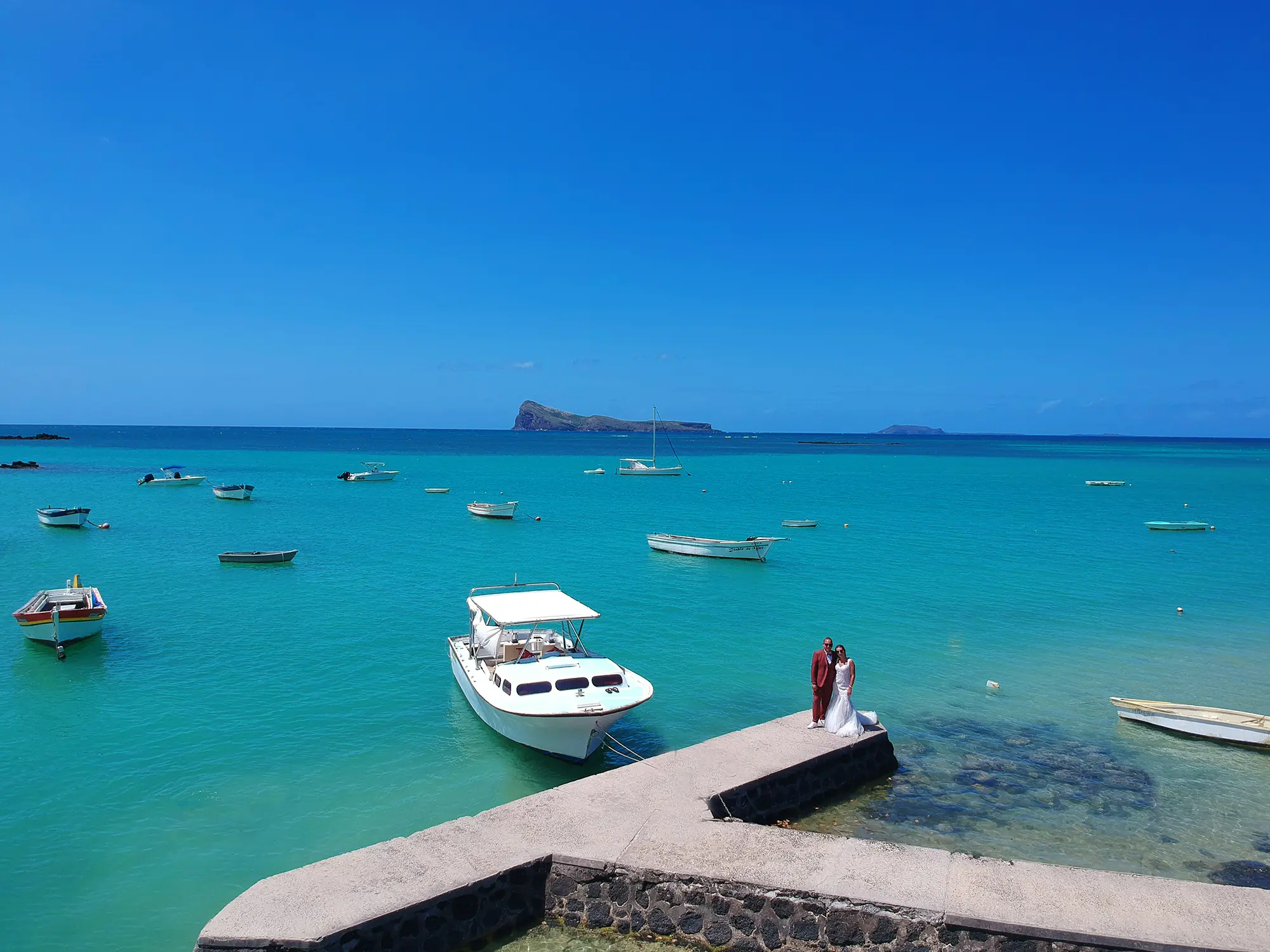
Walk to the small public beach to the east (left, as you face the sea) of the church. From here you can frame the full church — red roof, white walls, the coconut palms behind it — with the Indian Ocean and Coin de Mire island filling the background. This is the definitive composition and the one that appears on every postcard. A 24–35mm lens captures the full scene. Shoot at a moderate aperture (f/5.6–f/8) to keep both the church and the distant island sharp. Best between 8am and 10am when the sun is to your left and lights the facade evenly without harsh shadows.
Position 2: From the Road, Full Facade
Stand on the road directly in front of the church gate, looking north. This gives you the full front facade with the sea visible on both sides and, if the boats are in, fishing vessels at anchor in the mid-ground. This composition emphasises the symmetry of the building and works well with a slightly longer lens (50–85mm) to compress the background and bring the island closer to the church visually. The road position can be busy with cars and motorbikes — arrive early in the morning or on a weekday afternoon for a cleaner frame.
Position 3: Drone from Low Altitude
A drone at 40–60 metres directly above the church reveals the full geometry of the red roof in a way no ground-level camera can. From above, the terracotta tiles form a vivid cross or rectangle of red against the white walls, with the ocean radiating in every direction and Coin de Mire island perfectly positioned to the north. Fly early (before 9am) for the softest light and the fewest people on the beach. Stay below 120 metres and comply with Mauritius Civil Aviation Authority drone regulations. I include drone in every photoshoot package — the aerial images from Cap Malheureux are consistently among the strongest in any gallery from the north.
Position 4: Couple Portrait Facing the Sea
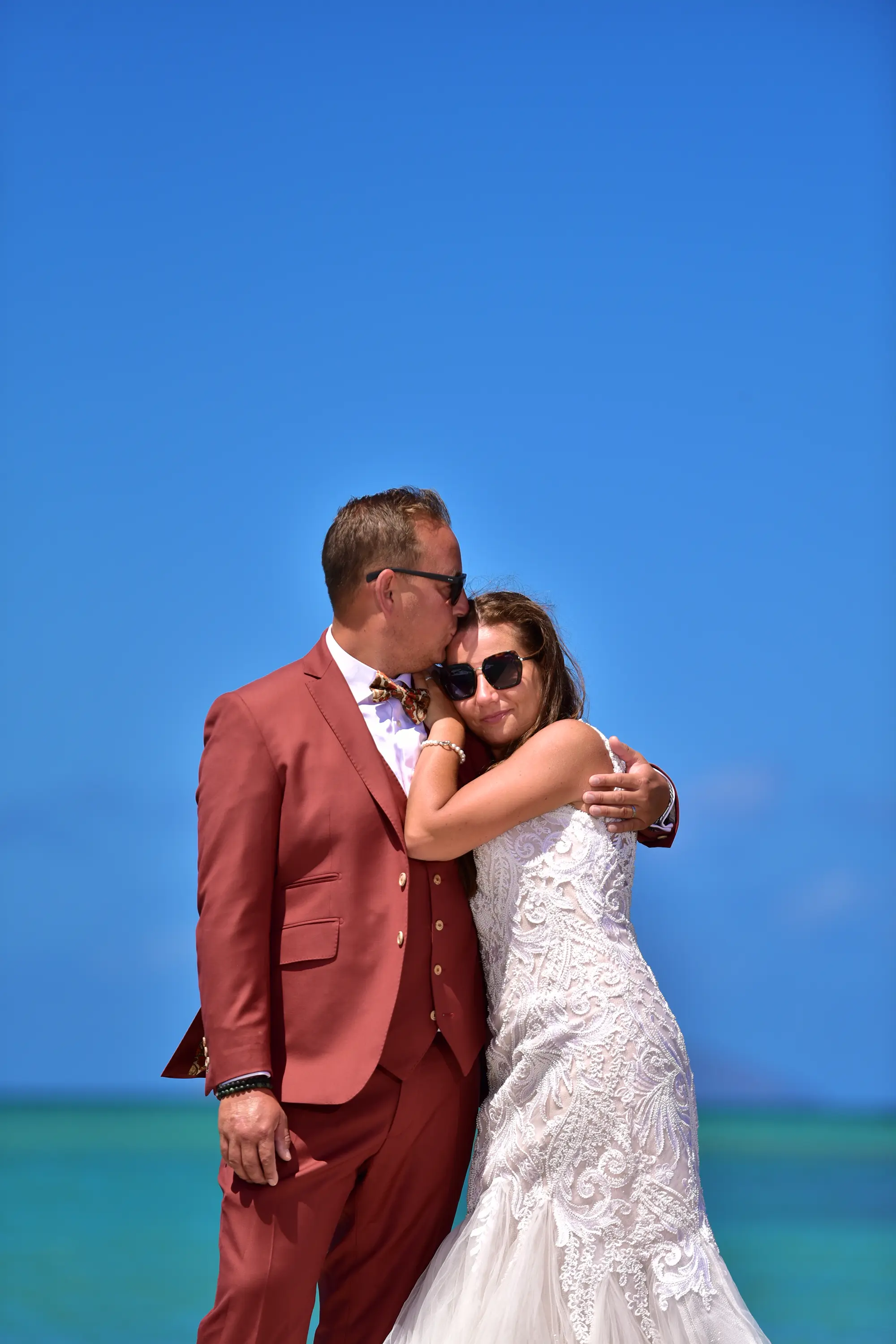
For couple or portrait photography, my preferred composition is two subjects standing on the beach to the left of the church, facing north (away from camera), with the church slightly behind and to their right and the ocean and Coin de Mire island filling the frame ahead. The subjects become the foreground element that anchors the scene, their backs to camera, the entire story of the location in front of them. In golden-hour light this produces images that are simultaneously intimate and epic — two people at the edge of the world. A 85mm or 100mm lens at f/2.8 separates the couple from the background while keeping enough definition in the church behind them.
Position 5: Sunrise Arrival at 6am
Arriving at Cap Malheureux at 6am — roughly 30 minutes before sunrise — gives you the location entirely to yourself and the possibility of dramatic pre-dawn sky colours over the ocean. The red tiles catch the first warm light almost immediately after sunrise, and for the first hour the beach is empty. This is the only time of day when you can reliably expect to have the church to yourself. By 8am, the first tour groups arrive. By 9am on a weekend, there may be thirty to forty people around the building. Come at 6am, get your frames, and leave before the crowds make the compositions impossible.
Coin de Mire — What Is the Island Visible from Cap Malheureux?
Coin de Mire (pronounced "cwan-duh-meer," French for "aiming coin" or "gunsight," named for its profile when seen from the sea) is a volcanic monolith rising 280 metres from the Indian Ocean approximately four kilometres north of Cap Malheureux. It is uninhabited and protected as a nature reserve under Mauritian law — meaning it cannot be landed on and has no structures of any kind. Its silhouette, especially at dawn or at dusk when it darkens against the sky, is the element that makes the Cap Malheureux view so dramatically layered. Without the island, the church has a beautiful sea background. With the island, the scene has a focal point at the horizon that pulls the eye through multiple planes of depth.
On clear days — particularly between May and September when the south-east trade winds clear the atmosphere of humidity — Coin de Mire appears sharply defined and almost close enough to swim to. On humid summer days (December–March) it can dissolve entirely into the haze. For photography, a clear day in June, July or August is when the island looks most dramatic from the church.
Can You Visit Coin de Mire?
You cannot land on Coin de Mire — it is a protected nature reserve and landing is prohibited. However, glass-bottom boat trips depart from Pointe aux Canonniers (approximately 3km west of Cap Malheureux) and circle the island, allowing passengers to view the underwater life around its base. These half-day excursions cost approximately €35 per person and typically include snorkelling stops at the reefs around the island. The water clarity around Coin de Mire is exceptional — visibility regularly exceeds 40 metres, and the underwater topography includes wall dives and boulders colonised by hard and soft corals. Dorado, trevally and barracuda are commonly seen. The boat trip is one of the better half-day excursions in northern Mauritius and worth combining with a morning visit to Cap Malheureux village.
The Village and Beach at Cap Malheureux
Away from the church, Cap Malheureux is a small, authentic fishing village with a character very different from the resort towns further south. The houses are modest, the streets are narrow, and the pace is what Mauritius used to feel like before Grand Baie became a marina town. For a photographer, the village is genuinely rich territory — the kind of place where you can spend an hour walking slowly and come back with thirty frames that say more about daily life in Mauritius than any resort beach shoot.
The beach directly at Cap Malheureux village is rocky with scattered coral rubble and is not suitable for swimming or sunbathing in the conventional sense. What it is excellent for is photographing local life. Fishing boats are pulled up on the beach in the morning and returned to the water in the afternoon. Fishermen repair nets under the shade of casuarina trees. At sunrise, the boats on the glassy water with Coin de Mire in the background and the sky going pink and orange above the island is a composition I return to every year.
For swimming, La Cuvette beach is 2km to the west, with a calmer lagoon and some grassy lawn areas suitable for families. It is less dramatic photographically but a perfectly pleasant place to spend an afternoon after visiting the church in the morning.
What's Nearby — Cap Malheureux and the North Coast
Cap Malheureux sits at the northern apex of a coastal arc that runs from Grand Baie in the west to Poste de Flacq in the east, encompassing some of the best beaches and most visited areas in Mauritius. Everything described below is within 15 minutes by car.
Bain Boeuf Beach — 2km East
A beautiful, relatively uncrowded beach with a calm, shallow lagoon protected by the offshore reef. The water at Bain Boeuf is particularly clear and ideal for snorkelling. There are no large resort developments here — a few small guesthouses and a beach shack or two — which keeps the atmosphere quiet. For photography, Bain Boeuf at sunrise is one of the better-kept secrets on the north coast: the lagoon goes mirror-flat in early morning and reflects the sky beautifully.
Pereybere — 5km South
Pereybere is the most popular beach in the north for younger travellers and Mauritian families. The beach is excellent for swimming and snorkelling — the reef is close and accessible from shore — and there are several good restaurants along the beach road. The atmosphere is livelier than Cap Malheureux and it has a different energy: more noise, more colour, more activity. For photography it is less iconic than Cap Malheureux but offers a different slice of Mauritian coastal life. The beach itself has fine white sand and the water colour at midday is vivid turquoise.
Grand Baie — 10km South
Grand Baie is the commercial and nightlife hub of northern Mauritius. The main bay is a marina with yachts, glass-bottom boats, catamarans, and jet-ski operators. The shopping is the best in the north (Super U supermarket, Sunset Boulevard mall, numerous boutiques). For dining there is a broad range from cheap local takeaways to proper restaurants. If you are staying in the north, Grand Baie is the practical base — most cap Malheureux visitors spend their evenings here. Photographically, Grand Baie's marina at golden hour, with the boats and the western sky, is a worthwhile subject in its own right.
Pointe aux Canonniers — 3km West
A quieter headland with a lighthouse and the departure point for most boat excursions to Coin de Mire and the northern islands. The point itself has good views north and west and is less visited than Cap Malheureux, making it useful for sunrise photography when you want something different. The beach at Pointe aux Canonniers is calm and family-friendly.
Getting to Cap Malheureux
Cap Malheureux is easy to reach by car or taxi. There is no direct public bus service to the village itself, though buses on the Grand Baie to Goodlands route stop at the junction 1km south of the village, from which it is a short walk or a brief taxi ride.
- From Grand Baie: 10km, approximately 10 minutes by car. Take the B13 road north from Grand Baie roundabout.
- From Port Louis: 45km, approximately 45 minutes by car via the M2 motorway north. Exit at Rivière du Rempart and follow signs for Cap Malheureux.
- From Sir Seewoosagur Ramgoolam International Airport (south): Approximately 1 hour 15 minutes by car — allow longer in peak hours.
- Parking: Free roadside parking is available near the church. It fills quickly on weekends and public holidays — arrive before 8am to secure a spot.
- Taxi from Grand Baie: Approximately €10 one way. Agree the fare in advance. Most drivers will wait for you if you ask them at the start of the trip.
- Rental car: The most flexible option for the north. Left-hand drive on British-style roads. The coastal road from Grand Baie to Cap Malheureux and along the north-east coast is scenic and straightforward to drive.
There is no entrance fee, no guided tour requirement, and no booking needed to visit Cap Malheureux. The church is open daily and the beach is a public beach. The entire visit — church exterior and interior, beach photography positions, a walk through the village — takes approximately 1.5 to 2 hours at a relaxed pace. Combining it with a morning at Bain Boeuf beach and lunch at a restaurant in Pereybere makes a full and varied day in the north.
Cap Malheureux — FAQ
Capture Your Mauritius Memories
Drone aerials. Golden-hour portraits. The turquoise lagoon as your backdrop. 15 years shooting Mauritius's most beautiful beaches.