Le Morne, Mauritius — The Complete Photographer's Guide
Last updated: June 2026 · By Bilaal Sadeer
There is no single location in Mauritius that does more things at once than Le Morne. A UNESCO World Heritage basalt monolith rising 556 metres directly from a turquoise lagoon. An underwater waterfall optical illusion visible only from drones. One of the world's five best kitesurfing destinations. A cultural landscape carrying the weight of the island's most painful history. And light — specifically the amber-gold light that falls on the western face of the mountain in the final hour before sunset — that I have been chasing with a camera for fifteen years and have never fully exhausted. This is the complete guide to Le Morne: its history, its geography, its photographic potential, and everything you need to know before you visit.
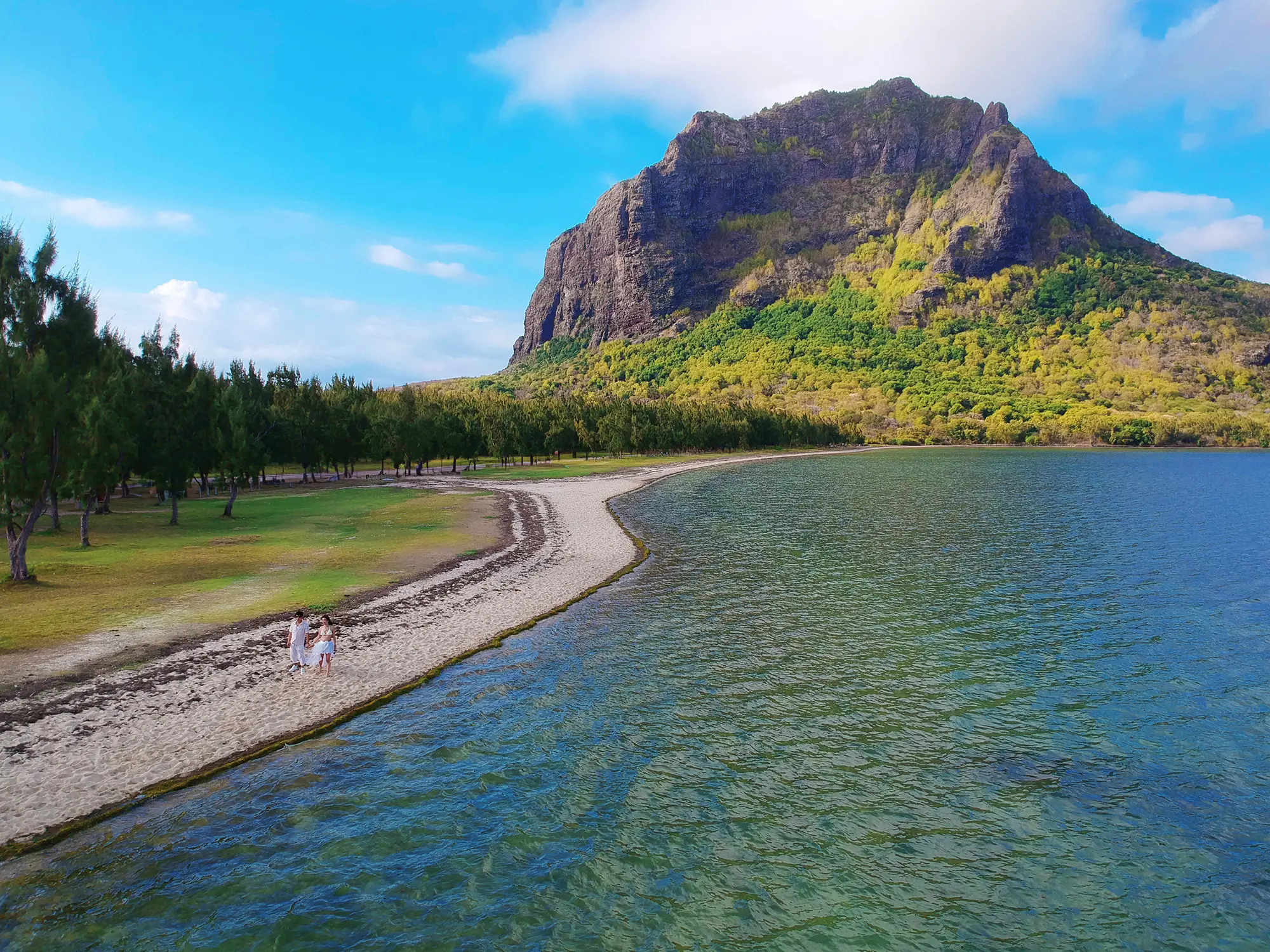
Le Morne, Mauritius — Key Facts
- UNESCO World Heritage Site listed 2008 — Africa's only Cultural Landscape on the UNESCO list.
- Le Morne Brabant rises 556 metres above the lagoon — a basalt monolith of volcanic origin.
- Lagoon depth 3–8 metres, visibility up to 40 metres in peak season.
- One of the top 5 kitesurfing destinations globally — consistent south-east trade winds year-round.
- Best photography: sunrise from the east facing the cliff + sunset from the west beach.
- Hotels directly on the beach: Paradis Beachcomber, LUX Le Morne, Riu Le Morne — all within 2km.
Why Le Morne is Mauritius's Most Photographed Location
Le Morne Brabant is not simply a mountain. It is a piece of geological theatre — a sheer-sided basalt monolith that erupted from the ocean floor some eight million years ago and now stands as the south-western anchor point of Mauritius, framed on three sides by water. The rock is dark and volcanic, almost black in certain lights, which creates an extraordinary contrast with the pale sand and the spectrum of blue and green water in the lagoon below. No other location on the island puts these elements — vertical rock, horizontal water, open horizon — in such perfect compositional alignment.
The geology explains the visual drama. Le Morne Brabant is the eroded remnant of a volcanic plug — the hard basaltic core of an ancient volcano that survived millions of years of erosion after the surrounding rock was worn away. The result is a nearly vertical cliff face on three sides, with a narrow, vegetation-covered ridge connecting the summit to the peninsula below. The mountain acts as a natural light trap: in the early morning, the rising sun from the east casts the cliff face in raking sidelight that brings out every fold and crack in the basalt. In the late afternoon, the western face glows amber as the sun drops toward the horizon behind it, and the lagoon in front turns from turquoise to deep gold.
What makes Le Morne uniquely versatile as a photographic subject is that it works at every scale. From a drone at 200 metres, it is an epic landscape — the mountain, the peninsula, the reef, the colour gradient of the ocean from shallow turquoise to deep navy, all in a single frame. At ground level on the beach, it becomes an intimate backdrop for couple portraits — close enough that the cliff fills the entire upper third of a vertical frame. In the middle distance, the mountain and the kitesurfers create a juxtaposition of natural permanence and human motion that no other location in Mauritius can offer.
The island's horizon completes the picture. Mauritius sits in the middle of the Indian Ocean; there is no land visible to the west of Le Morne. When the sun sets behind the mountain, the western horizon is pure ocean. The silhouettes this produces — of two people against the last light, with the mountain rising behind them and the ocean stretching to nothing in front — are the images that bring couples to Le Morne from every continent.
The UNESCO Heritage Story
Le Morne Brabant was inscribed as a UNESCO World Heritage Cultural Landscape in 2008 — making it the only site of its kind in Africa on the UNESCO list at the time of inscription. The designation is not for the mountain's geological beauty but for something far weightier: the mountain's role as a refuge for Marron slaves — enslaved people who escaped from the sugar plantations and settlements of colonial Mauritius and found shelter in the near-inaccessible caves and ledges of Le Morne Brabant.
Mauritius was colonised first by the Dutch, then by the French (from 1715), and finally by the British (from 1810). Throughout the French colonial period in particular, enslaved Africans, Malagasy and Indian people were transported to Mauritius to work the sugar plantations. Those who escaped — the Marrons — faced brutal punishment if recaptured. Le Morne Brabant, rising sheer from the sea on three sides and connected to the mainland only by a narrow, defensible ridge, offered something rare: natural fortification. Communities of escaped slaves sheltered here for decades, developing a hidden society in the mountain's folds.
The most poignant episode in Le Morne's history involves the abolition of slavery in the British Empire in 1835. According to the account that has passed into Mauritian collective memory, a group of soldiers was sent to Le Morne to inform the Marron community that slavery had been abolished and they were now free. Seeing uniformed soldiers approaching from below — indistinguishable from the slave-catchers who had pursued them for years — the Marrons chose to leap from the summit rather than return to captivity. They died on the day of their liberation, not knowing they were already free.
This history gives Le Morne a gravity that its visual beauty alone could not create. The UNESCO inscription recognises the mountain as a symbol of resistance to slavery and of the struggle for freedom across the African diaspora. A monument to the Marrons stands near the base of the mountain, and a path leads to a memorial point partway up the ridge. Visiting the memorial is a profound experience that deepens any encounter with the landscape — I recommend it to every couple and visitor I work with at Le Morne. The mountain does not look the same after you know its history.
Le Morne Beach and Lagoon
The lagoon at Le Morne is among the finest in Mauritius — protected by a continuous coral reef that runs along the south-west coast, breaking the Indian Ocean swell before it reaches the shore. The result is flat, clear, warm water that ranges from ankle-depth at the shoreline to 3–8 metres across the main swimming areas, with visibility regularly reaching 30–40 metres in the dry season. The water temperature averages 26–28°C year-round.
The lagoon divides naturally into two distinct zones, each with a different character. The western face of the Le Morne peninsula, running north from the mountain toward the major hotels, is the kitesurfing zone. The consistent south-east trade winds that funnel around the mountain create some of the most reliable flat-water kite conditions in the world — Le Morne regularly features in the top five global kitesurfing destinations. The kite schools operate in a designated corridor; outside those hours the beach itself is calm and swimmable, though the wind can be strong. Watching a kiteboarder ride with the mountain directly behind them is one of the great action photography opportunities in Mauritius.
The calmer swimming zone runs along the northern and eastern edges of the peninsula. Here the reef is closer to shore and the water is shallower and more sheltered. Snorkelling directly off the beach is excellent — the reef is intact and home to parrotfish, surgeonfish, hawksbill turtles and occasional reef sharks in the deeper sections. For families and couples who want to swim rather than kite, this is the side to choose. The water clarity at Le Morne — specifically the way it gradients from near-white at the shoreline through every shade of turquoise and green to deep blue over the reef edge — is what makes drone photography here so extraordinary.
A practical note on safety: the channel between the lagoon and the open ocean at the southern tip of the peninsula carries a strong current, particularly on an outgoing tide. Do not swim around the tip of the peninsula. The beach access points controlled by the hotels are always the safest choices. If you are visiting independently, stick to the northern beach where the water is calmer and there is no current risk.
Photography at Le Morne — 6 Specific Positions
After fifteen years photographing Le Morne, I have a set of positions I return to again and again. Each produces a different type of image; each works best at a specific time of day. Here they are in the order I typically work through them across a full shoot day.
Position 1 — East Beach at Sunrise, Facing the Cliff
The east-facing beach at the base of the peninsula, accessible via the road that runs around the northern side of Le Morne, gives you a direct view of the cliff face catching the first light of the day. Arrive 20 minutes before sunrise. The mountain is still in deep blue pre-dawn shadow when you set up; as the sun clears the horizon behind you, it hits the upper third of the cliff first — the dark basalt turning almost orange — while the lagoon in front of you is completely flat and mirror-calm in the absence of wind. This is the only time of day when the lagoon is reliably glassy; by 8am the trade winds begin. For couple portraits, position your subjects in the shallow water at the edge of the lagoon with the mountain filling the upper frame. The reflection of the cliff in the still water doubles the compositional impact.
Position 2 — Drone Above the Lagoon, Colour Gradient and Underwater Waterfall
Launch from the northern beach and fly south, keeping the mountain to your left. At 80–100 metres altitude, the full colour gradient of the lagoon becomes visible — the transition from white sand through every shade of turquoise, green and blue to the deep navy of the open ocean is one of the most visually arresting things I have ever seen through a drone camera. At the southern tip of the peninsula, the sand current creating the underwater waterfall illusion is visible on clear days between 10am and 2pm. Compose with the mountain in the upper left, the colour gradient running diagonally through the frame, and the waterfall illusion at the lower right. This is the signature Le Morne image — the one that exists on every photography best-of list about Mauritius.
Position 3 — Couple Portraits with the Cliff as Backdrop
Mid-morning (8–10am) on the west beach, the light is still relatively soft and comes at a low angle from the east, giving you a clean sidelight on faces while the cliff behind your subjects is in full shadow. Position the couple approximately 50 metres from the base of the mountain, shooting with a 70–135mm equivalent focal length. The compressed perspective makes the cliff appear to rise directly behind the couple, dwarfing them in a way that makes the human-versus-landscape scale visceral. For a brighter look, move farther back and use a longer focal length; for an intimate, enveloping composition, move closer. The dark basalt rock provides excellent separation for both light and dark outfits.
Position 4 — Golden Hour from the West Beach
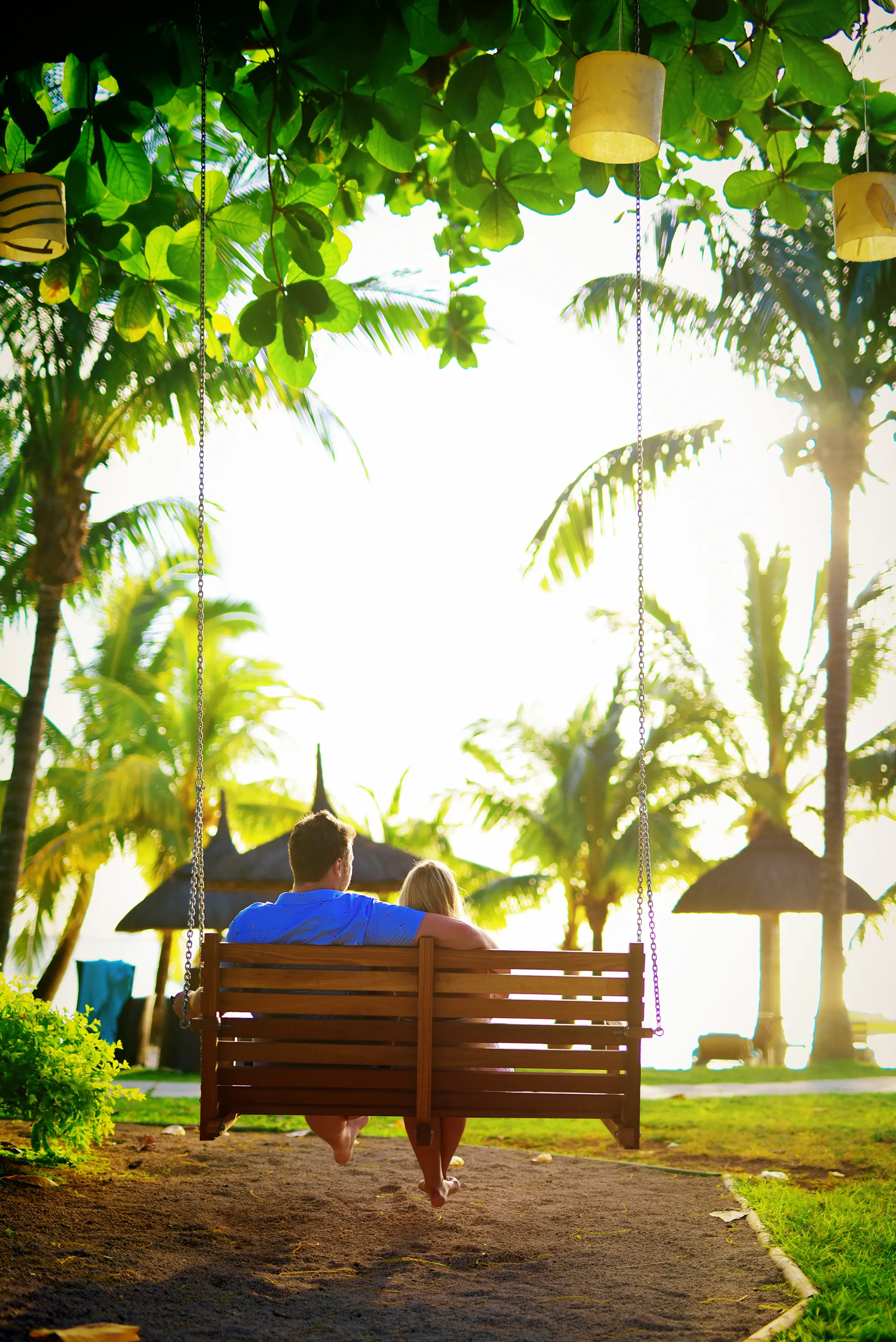
The hour before sunset on the west-facing beach in front of the major hotels is the defining Le Morne photography experience. The sun tracks behind and to the right of the mountain (from your perspective facing west), casting a warm amber sidelight across the entire beach. The water turns gold. The mountain's reflection, if the wind has dropped, appears in the shallow water at the shoreline. Position your subjects between you and the sun — slightly backlit — and expose for their faces rather than the sky. The rim lighting this creates is unlike anything achievable at any other time of day. Keep shooting past the moment of sunset; the sky holds extraordinary colour for 15–20 minutes after the sun drops below the horizon.
Position 5 — Aerial at 10am, Sand Current Optical Illusion
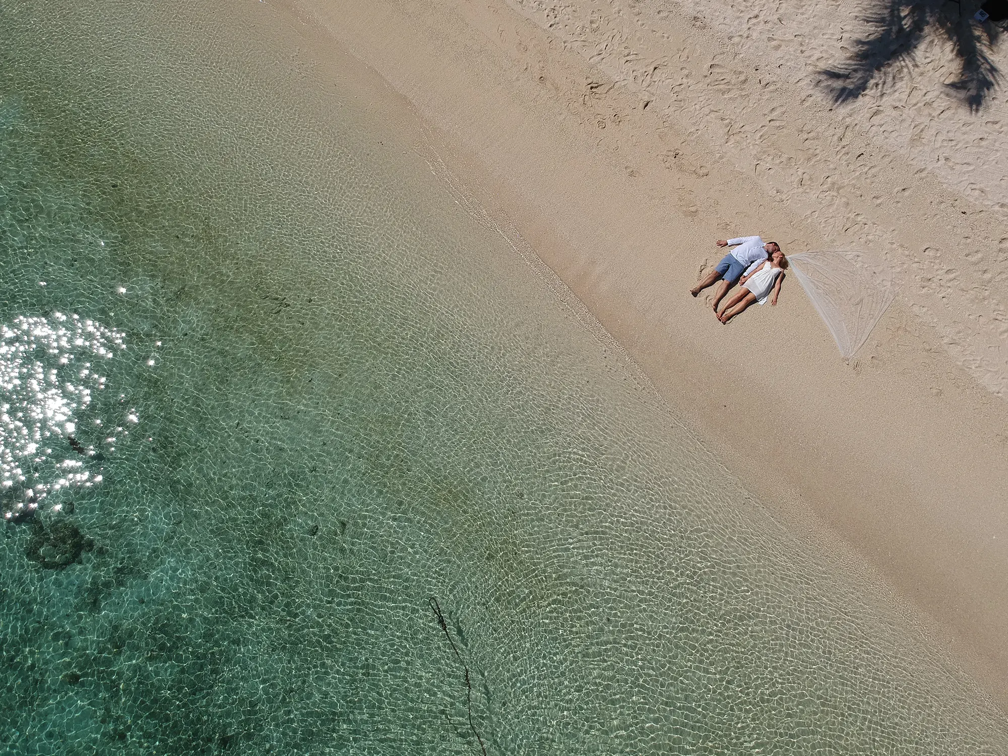
Between 10am and 2pm on a clear day, fly the drone to the southern tip of the Le Morne peninsula and position it at 80–120 metres altitude. The sand current — the flow of fine sand and silt off the continental shelf edge — creates the underwater waterfall illusion. From directly above or at a slight angle looking south, the sand stream cascades off the shelf in a spiral pattern that the eye reads instantly as a waterfall. Shoot with the highest contrast your camera allows — the colour difference between the shallow lagoon water and the dark deep ocean creates the visual drama. Polarising filters (if your drone supports them) significantly increase saturation. Allow 30 minutes at this position; the pattern shifts as the current changes, and the best frames often come 15 minutes into the hover.
Position 6 — Sunset Silhouettes
Twenty minutes before sunset, move your subjects to the waterline on the west beach and position yourself so the sun is directly behind the couple, slightly to one side of the mountain. Expose for the sky — your subjects will be in full silhouette. The mountain's dark profile on one side, the couple's silhouettes in the centre, and the Indian Ocean horizon stretching to the edge of the frame create a triptych that is simple, graphic and immediately legible as Mauritius. Shoot both portrait and landscape orientations; the landscape version works as a double-page spread, the portrait version works as a cover or Instagram frame. This position requires no posing — just proximity and trust between the couple.
The Underwater Waterfall — What It Is and How to Photograph It
The underwater waterfall at Le Morne is one of the most shared natural images in the Indian Ocean — and one of the most frequently misunderstood. It is not a waterfall. There is no water falling. What you are seeing is an optical illusion created by the movement of sand and silt on the seabed, and it is only visible from directly above, which is why it was essentially unknown before drone photography became widespread.
The geology behind it is straightforward. Mauritius sits on a relatively shallow continental shelf that extends south-west from the Le Morne peninsula. The shelf edge drops sharply from a depth of roughly 15–25 metres to several hundred metres in a short horizontal distance. Sand deposited on the shallow shelf by wave action is constantly moved by the ocean currents; when it reaches the shelf edge, it cascades down the steep underwater slope in a continuous stream. From above, looking down through clear water, the sand stream creates a spiral cascade pattern that the human eye — trained to interpret swirling, falling material as a waterfall — reads as exactly that.
The illusion is most powerful between 10am and 2pm, when the sun is high enough to illuminate the seabed through the water column rather than reflecting off the surface. Clear skies are essential — cloud cover flattens the contrast between the shallow turquoise water and the deep blue-black of the open ocean, and the illusion loses its impact. The best conditions are May through November, when the south-east trade winds clear the atmosphere and keep the water visibility at 30–40 metres.
For drone photography, fly to the south-western tip of the Le Morne peninsula and position the drone at between 80 and 120 metres altitude. Lower altitudes give more detail in the sand pattern but lose the colour gradient context. Higher altitudes show more of the gradient but the sand stream becomes a fine detail rather than a dominant feature. I typically shoot a series at different altitudes and select the frame that best balances the two. The optimal composition puts the sand stream in the lower third of the frame, the shallow lagoon occupying the upper two-thirds, with the colour gradient running from pale turquoise at the top to deep navy at the bottom. The visual impact is immediate and requires no caption — everyone who sees it understands instinctively that they are looking at something extraordinary.
A practical note: drone flying at Le Morne is subject to Mauritian Civil Aviation regulations. You must hold a valid drone permit for Mauritius and observe the exclusion zones around the Paradis Beachcomber and LUX Le Morne hotel properties. I carry all necessary permits and have been flying legally at Le Morne for over eight years. If you are organising your own drone session, check the current MCIA regulations before you travel — the rules have tightened since 2023 and enforcement is active.
Hotels at Le Morne
Three major resort hotels occupy the Le Morne peninsula, all within 2 kilometres of the Brabant mountain. Each has a different character and serves a different type of guest — and each provides a different photographic context for sessions on the grounds.
Paradis Beachcomber Golf Resort & Spa
Paradis Beachcomber is the most photogenic resort at Le Morne for weddings and couple photography. Its private beach stretches directly in front of the mountain, giving you an unobstructed sightline from the shoreline to the summit. The resort has hosted hundreds of destination weddings over three decades and its team understands photography access intuitively. The gardens along the beach path are beautifully maintained — mature tropical planting, bougainvillea-covered archways, and a pool that faces directly west toward the mountain sunset. I have worked at Paradis more than at any other Le Morne property; the golden-hour window on the west-facing beach here is, in my opinion, the single best photography moment in the south of Mauritius. See the full Paradis Beachcomber photography guide.
LUX Le Morne
LUX Le Morne takes a design-led approach that sets it apart visually from the more traditional Paradis property next door. The interiors are a mix of warm teak, textured concrete and curated art — excellent for editorial-style indoor sessions on rainy days or as a contrast to the beach shots. The infinity pool at LUX Le Morne is among the most photographed in Mauritius: it extends toward the mountain with no visible edge, creating the illusion that the water runs directly into the lagoon. For honeymoon couples who want a mix of resort-interior and beach-exterior photography, LUX Le Morne is the strongest choice at this location. Beach access is direct and the resort's section of the lagoon is calm and clear. See the full LUX Le Morne photography guide.
Riu Le Morne
Riu Le Morne is the largest of the three properties and suits larger groups — families, wedding parties, groups of friends. The scale of the resort means more variety in ceremony and portrait backdrops: multiple pools, gardens, beach areas and terraces. The beach access at Riu Le Morne is broad and the mountain views from the waterfront are excellent. For a group of 20 or more people needing simultaneous accommodation close to Le Morne beach, Riu is the practical choice. Photography from the resort grounds works well in both morning and evening light, though the western beach here is slightly less sheltered from wind than the Paradis section further south. See the full Riu Le Morne photography guide.
Getting There and Nearby Attractions
Getting to Le Morne
Le Morne is on the south-western tip of Mauritius, approximately 1.5 hours from Port Louis by car and 2 hours from Grand Baie. From Sir Seewoosagur Ramgoolam International Airport, the journey takes approximately 1 hour via the motorway toward Mahebourg and then the coastal road west. From Grand Baie, take the motorway south through Port Louis and follow the A3 toward Black River (Rivière Noire); from Black River it is a further 20–25 minutes along the coast road to Le Morne. The coastal route through Tamarin and Chamarel adds 30 minutes but passes through some of the most scenic landscape on the island.
Parking is available at the public beach access point at the northern end of the peninsula. Space is limited on weekends and public holidays; arrive before 9am for a guaranteed space. All three hotels have their own parking for guests. There is no reliable direct public bus service to Le Morne peninsula — rental car or taxi is the practical choice for independent visitors.
What Is Nearby
Black River Gorges National Park (30 minutes). The largest area of native forest remaining in Mauritius — 6,500 hectares of endemic vegetation, hiking trails, and Mauritius's endemic birds including the Echo Parakeet and the Mauritius Kestrel. The viewpoints over the gorge from the main road provide dramatic landscape photography in morning light.
Seven Coloured Earth of Chamarel (45 minutes). A geological curiosity produced by the differential cooling of volcanic lava — soil layers of seven distinct colours, from deep red through purple, blue and yellow, in a naturally sculpted landscape. Best photographed in the two hours after sunrise when the light rakes across the dunes at a low angle. Combined with a stop at the Chamarel waterfall, it makes a half-day excursion from Le Morne.
Tamarin and Black River (20 minutes). The west coast fishing villages closest to Le Morne. Tamarin Bay is one of the few surf breaks in Mauritius and has a low-key, non-resort atmosphere that contrasts well with the polished hotel strip at Le Morne. Black River is the departure point for big-game fishing charters and for dolphin-watching boat trips into the deep water west of the reef.
Bel Ombre (30 minutes south). The south coast's most established resort area, home to Heritage Le Telfair and Heritage Awali. The rugged south coast landscape — dramatic cliffs, darker water, wilder vegetation — is distinct from the sheltered lagoon at Le Morne and worth exploring if you have extra days on the island.
Le Morne, Mauritius — FAQ
Capture Your Mauritius Memories
Drone aerials. Golden-hour portraits. The turquoise lagoon as your backdrop. 15 years shooting Mauritius's most beautiful beaches.